Malta's spatial data got a makeover through an EU-funded integrated information system project which extends from a new basemap (last drafted in 1988) to the launching of an online information system that brings together data from different entities and partners.
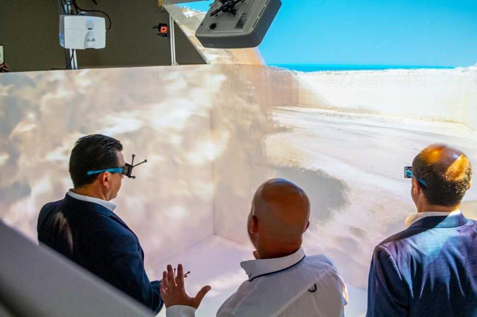
SIntegraM, an EU project partially financed by the European Regional Development Fund (ERDF) led by the Planning Authority (PA), is a foundation project that is revolutionising data as we know it: converting Malta into a three dimensional world capable of being explored through virtual reality, augmented reality, and-now-mixed reality.
On a visit to one of the more immersive elements of this project, the SIntegram CAVE, (Computer Automated Virtual Environment), Minister for the Environment, Climate Change and Planning Aaron Farrugia said that this project benefits society as it can take a snapshot of our environment, travel within it, review the changes that would occur, understand the rise of sea levels, and a myriad other possibilities. He explained that this system will allow for proposing and monitoring of green infrastructure, as well as aid in enforcement: it will provide tools to monitor infringements, rural offences and urban abuses.
The Parliamentary Secretary, Stefan Zrinzo Azzopardi, stated that with the investment of 7 million euro in European funds, a project is being conducted to gather information in one centralised system, which will facilitate the planning process and gather a more detailed outlook on our environment. Parliamentary Secretary Zrinzo Azzopardi explained that this system will be collecting information not solely from land, but also underwater and from above by means of drones so that through a digitalised process a virtual image will be produced of various Maltese sites. The Parliamentary Secretary said that this project led to a wider form of digitalisation in various fields including planning and Maltese geography.

Project leader Ms Ashley Hili said that through this project the Planning Authority aims to develop a national spatial data infrastructure and enhance the capacity of geo-spatial/GIS technology expertise for Malta. The project constitutes the creation of a strategic approach to spatial data, creation of critical base datasets, as well as enabling a legislative and mentality shift in terms of exchange and access to data.
"Since the launch of the Cloudisle Initiative that depicted the first 3D map of the Maltese Islands in 2017, technologies have advanced drastically, and the University has been instrumental in ensuring that this project has tangible goods for society. Through insight and inter-entity collaboration, we have pushed for foresight, and then pushed the envelope for social wellbeing," said Prof. Saviour Formosa, who conceptualised and drove the SIntegraM project.