The Planning Authority is set to decide on the latest version of the Manoel Island master plan proposed by MIDI this Thursday.
The application was last discussed in December, however a decision on the proposed amendments to the Manoel Island master plan was deferred due to a lack of adequate documentation presented, with concerns about a lack of photo montages comparing the proposed amendments with the already approved plan.
Furthermore, the board asked that documents which were found not to have been made available to the public to be uploaded for public viewing. During that meeting, a PA official had also confirmed that 8,000 sqm. of development space reduced from Manoel Island will be transferred to Tigne Point, and further clarification on this issue was requested by a member of the board. MIDI PLC have a concession for both sites.
The Outline Development application proposes “a change in the building configuration and an increase in open spaces. It also proposes a reduction of 8,000 sqm floor area of already approved development resulting from a decrease in massing, increase in residential component, decrease in commercial component and removal of offices. It proposes a re-design of the access to Manoel Island and the re-organisation of parking areas and berthing facilities, Alterations to the breakwater, restoration of the existing pay office and relocation of the guard house are also proposed.”
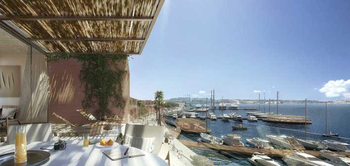
Manoel Island, formerly known as ‘Isolotto’ in the Knights’ times, is a leaf-shaped island with an approximate area of 305,000sq.m and is located at the heart of Malta’s largest and most densely populated conurbation within Marsamxett Harbour, with direct visual links to Tigne’, Sliema, Gzira, Ta’ Xbiex, Msida.
Since the board discussion’s deferral, a photomontage superimposing the alterations over the original master plan has been submitted, as were other documents.
The application itself has seen widespread criticism, and a petition was launched calling for the whole of Manoel Island to be turned into a park. So far, the petition in Parliament has seen over 5,600 signatures. The petition, specifically, asks to turn Manoel Island into a wooded park with heritage buildings set in much-needed open green spaces, to retain and upgrade the Gżira promenade, and to transform Manoel Island into a recreational zone for youths, families, hobbyists, the elderly, tourists and the community at large.
Recently, a pressure group named Inhobbu l-Gzira was also formed with the principal aim of “bringing modifications to the proposed Midi masterplan for Manoel Island". The newly-formed group said in a statement that the plan in its current form requires the transformation of a large part of the seaside promenade into an access road or bridge to Manoel Island, pointing out that the promenade is very popular, particularly in summer. It also criticized the loss of the Valletta skyline, the bastions, views of Pieta and Ta’ Xbiex due to two apartment blocks that are planned to be built on reclaimed land right opposite Triq ix-Xatt, that are said to rise to 29.75m,
The application’s case officer’s report highlights that the proposal includes the rehabilitation, integration and reuse of the existing heritage structures, with Fort Manoel, the Lazzaretto, the Customs House, St. George’s Chapel, the Cattle Shed, the Admiralty Canteen, the Pay Office, the Guard House and the Boat Builders’ Workshop given relevant uses. Additionally the glacis will be renovated into a public park.
This application also seeks amendments to the urban form, the report read. “The objective is to achieve a better balance between the built-up massing and the open spaces, done through a change in the site boundary and changes in the building configuration. Additionally the proposal will reduce built-up development by 8,000sq.m, reducing such massing and increasing the open spaces. As for land use the development seeks to decrease the commercial components, including outright removal of offices, and increasing the number of residences.”
In terms of accessibility and connectivity, the proposal consists in the repositioning of the bridge from the previously approved location, facilitating traffic management and mitigation measures. “The application also seeks to reduce vehicular dependency by promoting alternative accesses, mainly through the construction of a secondary pedestrian and cycle lightweight bridge and water taxi / ferry berthing points. The majority of the island will also be pedestrian-friendly, with very limited access to exceptional circumstances and emergencies. All 2,581 car parking and servicing facilities will be located below ground level and accessed through the main entrance node of the island.”
The construction of training facilities and requirements for both the Gzira Football Club and the Gzira Bocci Club is also included in this application.
The case officer recommended that the application be approved.